Great Himalayan Trip Upper Dolpo to Jomsom Trek


Overview
The best trek Nepal has to offer for those who are fit and have time.
Upper Dolpo extends the Tibetan plateau to the Dhaulagiri ranges. The entire district opened to trekkers only in 1989 when the southern part of Dolpo was opened to organized trekking groups. From Kathmandu, we fly to Nepalgunj and then to Juphal from where we begin our trek in the Dolpo region which was made famous by Peter Matthiessen’s book - The Snow Leopard. Nepal’s first English subtitled movie on Dolpo, the Caravan, was also a huge success and was also nominated for the Oscar Award in the best foreign language film category. On our 28-day trek we pass through interesting villages, trekking routes and meet fascinating people. We also cross a few high Himalayan passes and enjoy the vast and tranquil beauty of Phoksundo Lake.
Itinerary
Upon arrival at the Tribhuwan International Airport, after having gone through all arrival formalities you come outside where our representative will be waiting with a signboard will meet you and take you to our vehicle. At this point take care of your baggage as there may be volunteer helpers coming to you. Loss of baggage is possible. We then proceed to our hotel that will take about half an hour. OUR HOTEL WILL BE EITHER Hotel Kailash kuti/ Thamel Park or Shanker Hotel. When we arrive at the hotel you will be given your room keys and advised to the reception after 15 minutes for quick brief and collection of the passports by our office staff. In case you need to change your money into Nepali money, please ask the office staff. Evening meal will be in the hotel restaurant. YOU WILL ALSO BE ISSUED YOUR DUFFLE BAG, SLEEPING BAG AND THE DOWN JACKET TO BE RETURNED AFTER THE TREK.
Overnight: Hotel Kailash kuti/ Thamel Park or Shanker Hotel Meal: DinnerTrek preparation and permits documentation until we depart from hotel for flight to the domestic airport. Nepalgunj in Western Nepal. It is a large city in the Terai with a hot and humid climate.
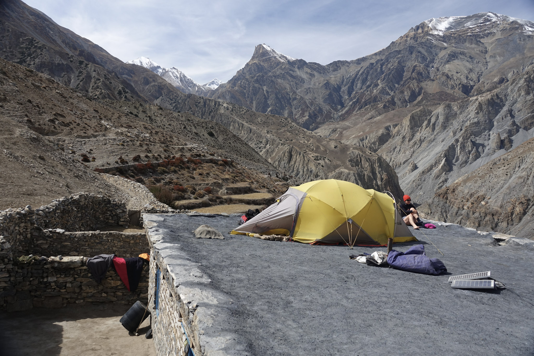
Overnight: Lodge Meal: BreakfastAfter an early morning start we take a flight to Juphal the main airport of the Dolpa district. After an exciting landing at the narrow mountain airstrip we meet the trek crew. Once the porters have loaded up and after final preparations we start walking through terraced fields to the Thuli Bheri river and then up to the riverside camp of Rupgad near the confluence of Thuli Bheri and the Suligad Khola (river) on the way to Dunai.
Overnight: Camping Meal: Breakfast , Lunch , DinnerIf buffer day is not used waiting for the flight to Juphal then this could be utilised if there are any other delays experienced during the trek.
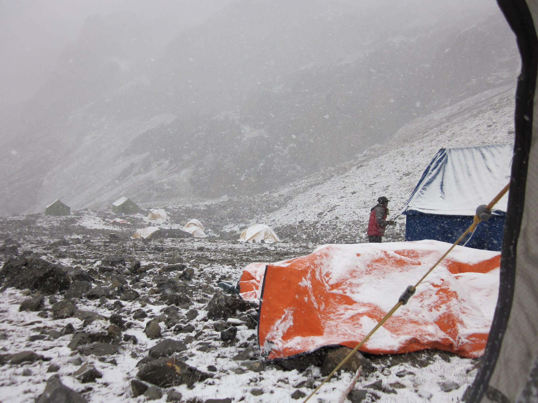
Overnight: Camping Meal: Breakfast , Lunch , DinnerFrom the camp we cross a new suspension bridge at the confluence with Suli Gad River flowing down from Phoksumdo Lake. At Sulighat our permits will be checked at the entrance to Shey Phoksumdo National Park, this is Nepal’s largest and the only trans-Himalayan National Park in Nepal covering an area of 3,555 square kilometres. For the rest of the day we follow the Suli Gad, passing through thick forests of pine, fir trees and some giant red cedars. The hillside is covered with lush vegetation and it is likely we will see troops of monkeys. We pass the basic houses of Jyalhasa the winter settlement of the villagers from Ringmo. Further along we reach the grassy campsite at Chhepka in a small Tibetan village, look out for the local women who wear Tibetan turquoise, coral and amber necklaces. Rupgad to Lunch 3 hours walking Lunch to Chhepka 3 ½ hours walking.
Overnight: Camping Meal: Breakfast , Lunch , DinnerToday the trail goes over to both sides of the valley with crossings on good bridges sometimes we walk near the river and other times on a narrow path high above the river. We pass through hauntingly beautiful forests of pine trees, larch and birch with several bamboo stands further up the valley. By the afternoon the valley widens out and we pass a river confluence, one trail follows Pugma Khola towards Kagmara Pass whereas we follow the Phoksumdo Khola heading north where we reach a bridge that leads to Amchi Hospital. “Amchi” is name for traditional Tibetan medicine developed specifically for the climatic and cultural conditions of the Tibetan plateau. We eventually reach Palam a deserted settlement. We set up our camp here. Chhepka to Lunch 4 hours walking Lunch to Phalam 3 hours.
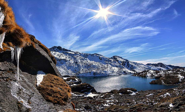
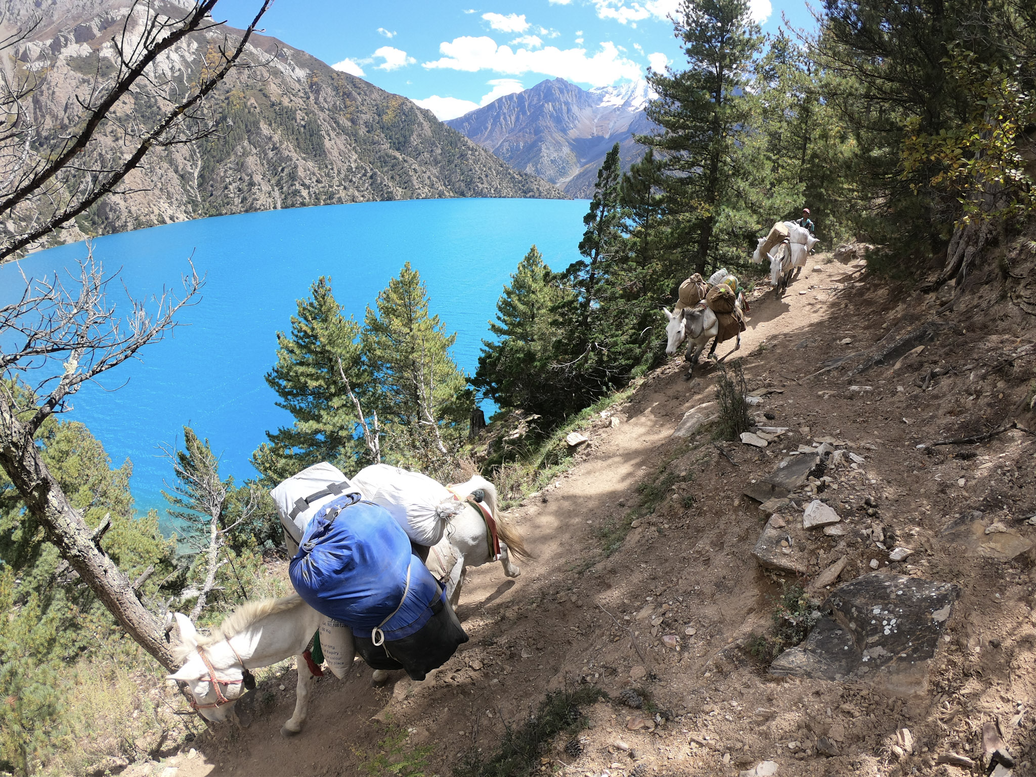
Overnight: Camping Meal: Breakfast , Lunch , DinnerFrom here we begin to climb up for about an hour to a viewpoint at 3850metres. From here we see highest and largest waterfall in Nepal. The vista is the Phoksumdo valley with its lush green pine forest. The trail descends through a birch forest to the mud plastered chortens and mani walls at the entrance to Ringmo village, it is a short walk to the camp on the shores of the stunningly beautiful Phoksumdo Lake. It takes about 5 hours walking to Phoksumdo Lake and this is our lunch camp today.
Overnight: Camping Meal: Breakfast , Lunch , DinnerToday we visit the nearby Bönpo Buddhist monastery overlooking Phoksumdo Lake and then explore Ringmo village. Bönpos circumambulate chortens or other religious structures anticlockwise rather than clockwise as done by Buddhists.
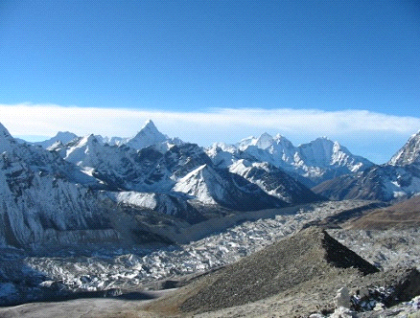
Overnight: Camping Meal: Breakfast , Lunch , DinnerWe enter Upper Dolpo beyond Ringmo where we have to show our restricted area permit. We follow the trail on the western side of Phoksumdo Lake along a narrow cliff trail. After half an hour we enter the blue pine forest and then come to a wide trail with several switch backs to high point from where we enjoy the great view of the lake and the beautiful surrounding. We enjoy views of the peaks of Kanjiroba (6,612m), Norbu Kang (6,085) and Jhyarko Dingla (5,892m). We make a gradual descent through stands of birch trees to our campsite on the northern shore of Phoksumdo Lake.
Overnight: Camping Meal: Breakfast , Lunch , DinnerFrom the camp we follow a wide valley with several tributaries of Phoksumdo Khola. After about two hours walking through pine and birch forest, we pass Chunemba camp. +We have lunch at the river confluence, after we follow a high trail over a grassy ridge avoiding the narrow gorge and then join the Tuk Kyaksa Khola where it widens below Lar Tsa Camp. This area is famous for the picking up of Yarshgompa, a caterpillar fungus. The fungus is a medicinal mushroom which is highly prized by practitioners of Tibetan and Chinese medicine in which it is used as an aphrodisiac and as a treatment for a variety of diseases. In May and June each year many people travel to this area to collect yarshagompa. There is a spectacular view of Kanjiroba Himal (6,612m) from Lar Tsa camp. We stop here, rather than continuing onto Snowfields Camp, because it is essential for acclimatization for crossing Kang La Pass. If Kangla Pass is blocked by snow then the leader and the guide will decide an alternative route to Shey.
Overnight: Camping Meal: Breakfast , Lunch , DinnerFrom Camp we continue walking up the valley with juniper and azalea then cross the river on a bridge. We then climb a scree slope on a switchback trail to a crest before descending to the Pass Camp located next to the river, at the foot of Kang La that crosses into Dolpo. After lunch we explore towards the pass for more acclimatization and also to see the path. On the way we might see herds of blue sheep.
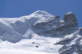
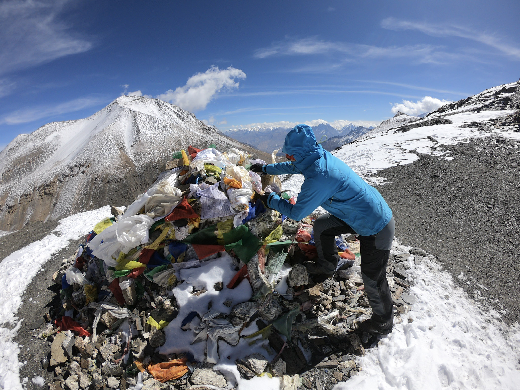
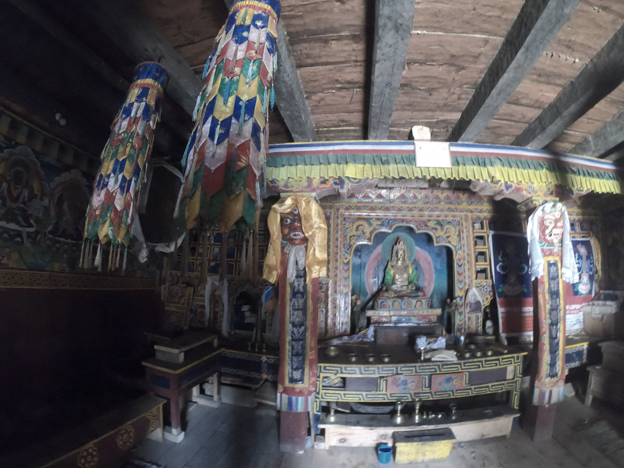
Overnight: Camping Meal: Breakfast , Lunch , DinnerLeave the camp then cross the river. We then walk up grassy slopes to join the valley approaching Kang La. There are two passes and we take the left with our mules and porters over the pass to the left. The trail is on loose, scree souse your trek king poles. We will be at the pass in about 3 hours, the pass is at an altitude of 5380metre. Enjoy the breath-taking view of panorama of mountains in Tibet to north and huge massif of Dhaulagiri visible to east. The descent from the pass is on soft scree making for a rapid descent down to Hubajung Khola where we have lunch. Shortly after the valley narrows to a gorge made of stratified orange rock, after an hour we pass a long mani wall and soon Shey Gompa is visible down the valley. Shey is located at a river confluence under Crystal Mountain so called because of the veins of quartz, this is the holiest mountain in Dolpo and known as younger brother to Mount Kailash in Tibet. Twice a year pilgrims make a kora (or circuit) of Crystal Mountain, according to the lama the kora takes them 12 hours. Our camp is erected below the gompa in a grassy area with several herders’ huts nearby.
Overnight: Camping Meal: Breakfast , Lunch , DinnerToday we explore Shey gompa. Later relax and also time for laundry. In the afternoon we plan to visit Tsakang Gompa. It takes about an hour to walk there and the plus point is we shall see herds of blue sheep along the route. It is also part of the pilgrims’ kora of Crystal Mountain.
Overnight: Camping Meal: Breakfast , Lunch , DinnerFrom Shey we head east following Sephu Khola passing many mani walls, several isolated fields and doksas (seasonal settlements for yak herders). After an hour or so, we follow a valley heading to the north east that approaches Saldang La through a narrow gorge, this opens up to a bowl with loose scree in varying colours of yellow and orange. On top of Saldang La the panoramic view of mountains to the north into Tibet, east to Mustang and west to Crystal Mountain and Kanjiroba. The landscape now resembles the arid Tibetan plateau with narrow gorges as seen in Upper Mustang. The scenery is spectacular with folded strata visible in the rocks from the tectonic uplift of the Asian plate. We descend from the pass keeping left as the dusty trail traverses through hillsides with virtually no vegetation. The trail continues descending to a stream then contours further until we see the ancient red and white gompa perched on the cliffs above behind Namgung village. There are only a handful of stone houses in the village as well as a new monastery. Shey to Lunch 3 hours Lunch to Numdang 4 hours.
Overnight: Camping Meal: Breakfast , Lunch , DinnerWe trek above Namgung village and there are good views back to Saldang La. After a few hours we reach a crest where we can see Saldang village below and mountains in Tibet to the north. We can see eagles soaring high in the skies. The Dolpo people lead a difficult life in this harsh environment trying to grow in this high, dry land as well as grazing large numbers of yaks and goats. Things they need are brought from Tibet on the backs of motorcycles. Also they use large caravans of yaks for manufactured Chinese goods. They also sell yarshagompa mushrooms collected in the area. In Saldang we will have lunch at Thinle’s house that has been popular from the film “Himalaya”. After lunch we take the high level trail to Karang village where the villagers will be busy working in their fields. We descend to the valley and walk along the river bank to our camp at Tora Sumda at the confluence of Nagon Khola and Panzang Khola.
Overnight: Camping Meal: Breakfast , Lunch , DinnerToday's walk is one of the highlights of the trek because it is culturally interesting region on the trek. We visit a valley close to Tibet rarely walked by other trekkers. This valley is very rich in wildlife, such as herds of blue sheep, musk deer, Himalayan fox and snow leopard. (You may spot a snow leopard). Shortly after Camp we cross the new bridge over Panzang Khola to the north bank. At Yangur village we will visit Dolpo’s oldest gompa surrounded by mani walls and several chortens. The valley after the village narrows to a beautiful gorge with colouful rock. We do not follow the Panzang Khola direct to Shimen village so we over Muri La. Tonight we Camp in a field on the outskirts of Mischagaon village also known as Mugaon. Tora Sumda to Lunch 4 hours Lunch to Mugaun 2hour s 30 minutes.
Overnight: Camping Meal: Breakfast , Lunch , DinnerWe walk through Mischagaon village then start climbing the slopes towards Muri La. When we look south west we will be able to see many 6000 metre plus peaks namely Tshu Kalpo Kang Serku Dholam and Tripura Thumba and from the pass there are superb views over to Dhaulagiri. It will take about 3 hours to complete the long ascent to the pass and 2 hours to descent to Chanpola Goth. There is a steep and loose descent from the pass so use your trek poles. After 500m below the pass we will stop for a lunch on a grassy spot near a river, then from there follow a gorge passing a small waterfall to Chanpola Goth 4250m. Heading north from here there is a trail to Tibet where there is frequently trading between Dolpo-pa and Tibetans. A further one hour walk we will reach Shimen Village. This village has large areas of terraced fields where they grow buckwheat, barley and potatoes. They now have a new school and the mani wall is over 600m long. .
Overnight: Camping Meal: Breakfast , Lunch , DinnerFrom the camp we follow the Panzyan valley which is one of the four main valleys that comprise Upper Dolpo, the others being Tarap, Nangkhong and Tsharka. After an hour we walk up a tributary river underneath overhanging conglomerate then climb up to reach Mendo Camp on a grassy shelf. Shortly we will see Pu gompa on the other side of the river, follow Panzang Khola for a further 1 ½ hour to our lunch spot next to Namygal chorten. After lunch the valley widens and after several hours we get to the hamlet of Phalwa which is inhabited by Tibetans. The men have red sashes in their hair. Soon we arrive at Tinje, this is a major village in a wide valley with massive fields with two gompas and an old fort. Tenzing Norbu Lama, famous artist was born in this village. At a very tender age he got trained in Tibetan thanka painting and became well known. His arts are now displayed internationally . Norbu train villagers from Tinje to paint and also produce leather handicrafts. Shimen Village to Lunch 3 hours Lunch to Tinje 4 hours
Overnight: Camping Meal: Breakfast , Lunch , DinnerFrom our camp we follow the Panzang Khola past ruins of an old settlement on the other side of the river. Affter about two hours we arrive to the river confluence where we take the left tributary Kehen Khola for a further hour to reach our lunch spot in gassy area next to the river. After lunch we resume walking up left bank of Kehen Khola passing several doksas before arriving at Rakpa where we camp for the night. Tinje to Lunch about 3 hours Lunch to Rapka 4 hours walking.
Overnight: Camping Meal: Breakfast , Lunch , DinnerToday is the longest day of the trek so we have to depart very early from the camp, your sirdar will tell you the time of departure. We walk up the valley for half an hour then cross the Kehen Khola ar. At the confluence near a yak herder’s camp we take the left river Myantoku Khola. This valley then opens out to a wide floodplain with a number of tributary rivers that we have to cross several times. We start climbing to reach a cairn at 4,950m then the valley widens again with many yaks grazing on the extensive pastures. From here you should be able to see the cairn and trail climbing to Chharka La. It should take another hour to reach summit of the pass where we will be rewarded with a spectacular view, after a short descent the huge Dhaulagiri massif is revealed on the right. It is a gradual ascent to the pass that will take about 5 hours. From the pass it takes a further 3 hours walk to get to Chharka village. After passing the entrance chortens and the school we then enter the old village with narrow alleys and their courtyards filled with goats, horses and yaks. There are 4 lodges, we will set up camp on the camping ground of Himalayan Hotel.
Overnight: Camping Meal: Breakfast , Lunch , DinnerBelow Chharka village we cross Chharka Tulsi Khola on a metal box bridge and then at river confluence cross on a suspension bridge to follow left bank of Thasan Khola. The trail contours high above the river following a number of undulating ridges. After crossing a landslip zone we descend to a grassy area for lunch. After lunch we resume walking up the valley where the gorge narrows and after we reach the doksa at Norbulung. Chharka to Lunch about 4 ½ hours walking Lunch to Norbulung 2 hours walking.
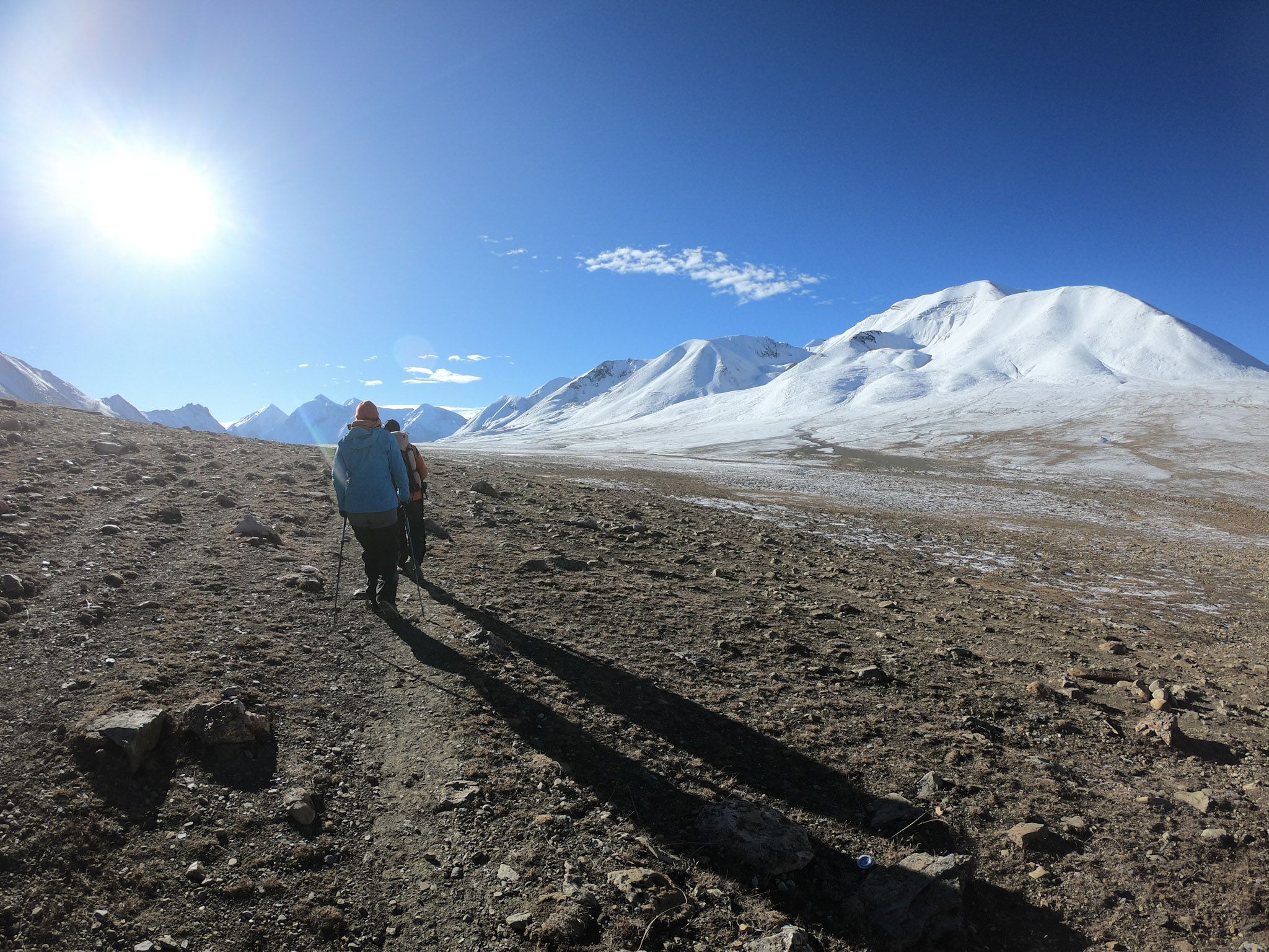
Overnight: Camping Meal: Breakfast , Lunch , DinnerWe depart very early, earlier than 6 o@clock. We pass through the high yak pastures of Molum Sumdo and then continue to a crest with a cairn at just over 5,100m. From here it is a further two hours to reach Sangda La walking across a grassy plateau with grazing yaks, we then start climbing the trail to the important Sangda La pass marking the boundary between Dolpo and Annapurna. The trail descends on loose scree to our Camp at Sangda Phedi next to Bheri Khola, this is our highest camp of the trek so it will be a cold night. Norbulung to Sangda La Pass 6 hours walking Sangda La to Sangda Phedi 1 and half hours.
Overnight: Camping Meal: Breakfast , Lunch , DinnerWe follow the Bheri Khola for about an hour then climb the lower Sangda La at 5,035m. The vista is superb over to Kali Gandaki valley and Thorong La plus a range of 6,000m peaks including Tongu Himal and Mukot Himal. From the pass it is a steep downhill walk on a slatey trail to a crest at 4800metre then a further downhill to a huge rock at 4500m. Here we take the left trail that passes by a waterfall. After that we come to a saddle and descend to a grassy plateau with pine trees. We then turn right along a new trail that is exposed in places to the new suspension bridge at 3,900m. We will have lunch by the bridge. From the camp to here takes 3 hours. After lunch there is steep climb. The trail then traverses high above Kyalunpa Khola. After an hour we cross a crest with prayer flags. We descend through a steep gulley to cross the first tributary river at 3,800m then we traverse for ½ hour to the second river again crossing on rocks. Soon after we will see the entrance chorten to Sangda village followed by a large wall around their fields. Over to the other side of the valley and there are the deserted remains of two villages because of no water. We erect our camp in the school ground above Sangda village. From the lunch spot it will be about 3 to 4 hours walking
Overnight: Camping Meal: Breakfast , Lunch , DinnerFrom the camp, we begin climbing to the first ridge at about 4000m then to the next ridge at 4100m. go downhill to a u-shaped valley to meet grazing yaks. When we look up we will see the peak of Tasarse 6343m soaring ahead of us. After 2 hours we shall reach the third ridge at 4200m. From here we see both the high and low Sangda La Passes that we have crossed. In half an hour we reach the fourth ridge and we will see a great view of the Kali Gandaki valley and the famous Thorong La. From the next ridge we shall be able to see and enjoy the great view of Thorong Peak, Nilgiri and Annapurna . Walk about 100m to a cairn above this pass to get views into Upper Mustang as well as down to Muktinath and Kagbeni. We head south and descend to a river gorge then continue to the last ridge from where we have views of the green fields of Pangling. We camp at Pangling or Phalyak tonight. Today we shall have packed lunch.
Overnight: Camping Meal: Breakfast , Lunch , DinnerToday we will be walking in the Kaligandaki Valley. We will cross by the suspension bridge and walk along the road to Jomsom. Ensure to have your sunglasses handy as there will be strong wind. In three hours we will be at Jomsom. After checking into one of the lodges we can explore the town then in the evening the cooks will produce a special last meal together. Later on we will give tips to our crew as a thank you gesture for all their hard work throughout the trek
Overnight: Teahouse Meal: Breakfast , Lunch , DinnerWe take an early morning flight to Pokhara then onto Kathmandu. (In case of inclement weather, take a jeep to Pokhara then flight the next morning Hotel in Pokhara Hotel Big Pillow Inn or Hotel Mala.)
Overnight: Hotel Meal: BreakfastFree day in Kathmandu.
Overnight: Hotel Meal: BreakfastOur representative will drop you to the airport.
Meal: BreakfastCost
US$ 5400 per person (minimum pax: 5)
Cost Include:
- Airport pickups and drops in a private vehicle
- 3-star hotel accommodation in Kathmandu with breakfast
- Full Board Camping accommodation during the trek
- All meals (breakfast, lunch and dinner) during the trek
- Welcome and farewell dinners
- All ground transportation on a comfortable private vehicle as per the itinerary
- Domestic flights (Kathmandu- Nepalgunj –Jhupal/ Jomsom-Pkr-Ktm)
- Guided city tour in Kathmandu by private vehicle
- Entrance fees for sightseeing/monument visits as per the itinerary
- An experienced, English-speaking and government-licensed trek leader and assistant trek leader (4 trekkers: 1 assistant guide)
- Porter service (2 trekkers: 1 porter)
- Staff costs including their salary, insurance, equipment, domestic airfare, food and accommodation
- Down jacket, Duffel Bag and sleeping bag (to be returned after trip completion)
- All necessary paperwork and trekking permits (National Park Permit, TIMS)
- Medical kit (carried by your trek leader)
- All government and local taxes
Cost Exclude:
- Nepalese visa fee
- Excess baggage charge(s)
- Extra night accommodation in Kathmandu because of early arrival, late departure, early return from mountain (due to any reason) than the scheduled itinerary
- International flights
- Travel and rescue insurance
- Personal expenses (phone calls, laundry, bar bills, battery recharge, extra porters, bottle or boiled water, shower, etc.)
- Tips for guide(s), porter(s) and driver(s)
Equipment
N/A